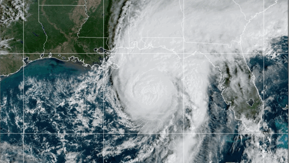
Your first question about this latest weather threat may involve how to pronounce Hurricane Isaias. For those not sure, it’s “Ee-sah-EE-ahs.” A second question may concern how bad of a punch is this storm actually going to bring. And the jury, as usual, is still out on that one. For now, Southern Baptist disaster relief teams remain on standby in Florida, Alabama and other potentially impacted states as the storm approaches the northern Gulf Coast, according to Send Relief crisis response director Coy Webb.
Waiting game
“We are mainly waiting to see how the storm materializes, and it is still uncertain on what the impact will be,” Webb reported Friday morning as Southern Baptist Disaster Relief directors met. “I would guess it comes in as a Cat-1 but potentially could be Cat-2 … and we do not still know how much the wind shear will impact it before landfall.”
The storm reportedly strengthened to a Category 3 hurricane Friday morning with 120 mph winds, according to CBS News and The Associated Press. Forecasters expect the storm to make landfall late Friday or early Saturday near the Alabama-Florida line.
As usual, these types of storms threaten coastal communities and can pack dangerous storm surges, flash flooding and even a threat of tornadoes. According to the latest report, the storm could drop 15 inches of rain in parts of the Sunshine State. Officials are urging residents and visitors to wrap up any storm-related planning soon as weather conditions deteriorate.
See related links:
Hurricane Isaias set to slam Gulf Coast -The World and Everything in It
Isaias strengthens into a dangerous Category 3 hurricane on track toward the US Gulf Coast -Associated Press
Hurricane Isaias becomes Category 3 storm as it threatens northern Gulf Coast -CBS News
The links above are a sampling of headlines related to the story and are not an endorsement of all viewpoints or reporting.
EDITOR’S NOTE — This story was compiled from various news outlets by The Baptist Paper.